Ruler

Ruler
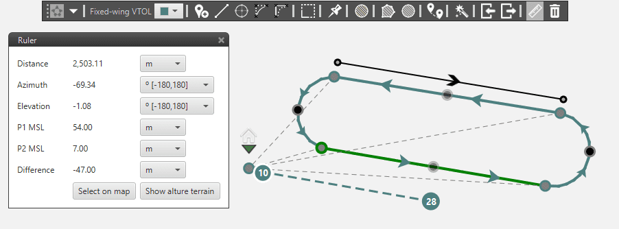
Ruler Example
Using the ruler, you can measure:
Distance: distance between two points.
Azimuth: angle of the segment with the North.
Elevation: shows you the angle of the segment respect to a horizontal plane.
P1/P2 MSL: altitude respect to the the Main Sea Level of the points P1 and P2.
Difference: height difference of the points P1 and P2.
You can choose the units of the measures.
Select on Map. Restarts the measurement.
Show alture terrain. Shows the terrain profile between the ruler points
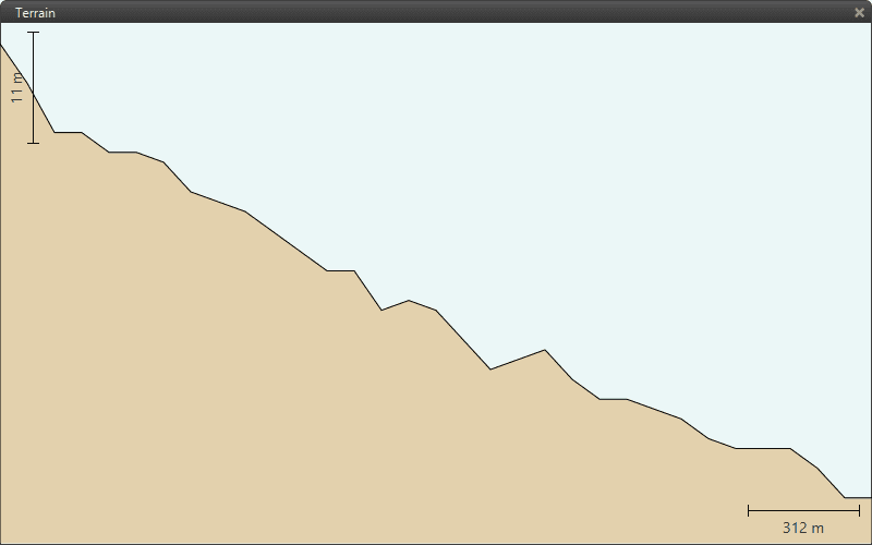
Terrain Profile