Map
If you click in:

Map Tool
In the map menu, the user can choose the coordinate preference (from MGRS, Decimal Degrees and Degrees) and download the Terrain Height.
Terrain Height

Map Menu
You can select the units of the coordinates clicking on a)
In order to perform the altitude estimation, Veronte installs a GIS (Geographic Information System) consisted of two meshes. When creating a mission, the terrain altitude on the mission area is automatically downloaded from the internet.
Download ALtitude Information
If the flight operation is carried out in an area where there is no internet connection, the altitude information can be downloaded a priori. To download the information:
Select Providers terrain height and press button 1.
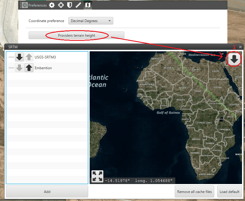
Terrain Height
Click on a quadrant to download the information of that zone into the system.
There are two providers of altitude information in Pipe:
The first one is the SRTM3 (shuttle radar topographic mission 3) which contains the altitude information for the territories outside the United States (the number 1 is for USA).
The other one is a server created by Embention with altitude information of areas that do not appear on the SRTM such as Iceland.
Custom Terrain File
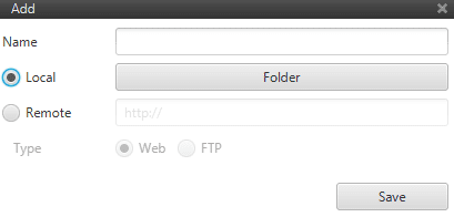
Pipe also provides the option of introducing a custom terrain file.
Clicking on Add appears a menu with two options to charge a terrain file in the system:
Local: allows the user to select a file from the computer.
Remote: gives the option to introduce a URL (Un*iform Resource Identifier) of an altitude provider from both a web or FTP (File Transfer Protocol) server.
Custom Terrain Altitude Source