Terrain
Terrain display shows the terrain profile on the platform direction. Visualization configuration options are as follows:
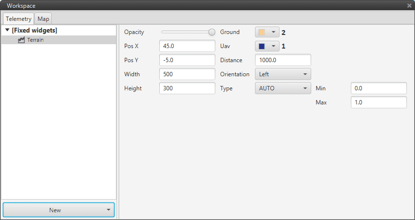
Terrain Profile Configuration
In the dropdown on the top right corner, the user can select the Veronte to be used in this widget.
Item |
Description |
|---|---|
Opacity |
Change widget opacity. |
Pos X/Y |
Define widget’s position in the screen’s X/Y axis. |
Width/Height |
Define widget’s width/height. |
Ground |
Select ground’s color. |
Uav |
Select UAV’s color. |
Distance |
Change distance range. |
Orientation |
Define UAV ahead orientation (from left to right or the opposite) |
Type Min/Max |
Select where the program catch the variables. |
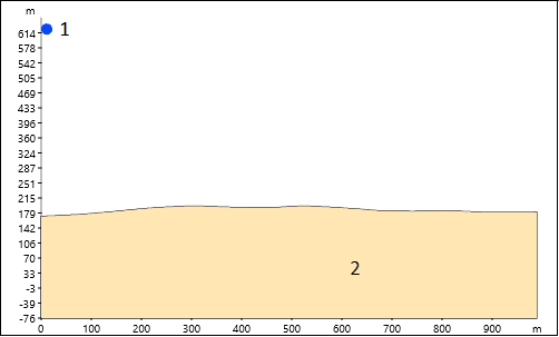
Terrain Profile Widget Display