Mission
Even though it is recommended that the mission is already defined before the operation starts, it is possible to load a new mission or modify the current mission before and during the operation.
Within the Operation menu, the Waypoint tab can be accessed. In here it is possible to find a list of all elements that belong to the current mission, including Waypoints, Polygons and Obstacles.
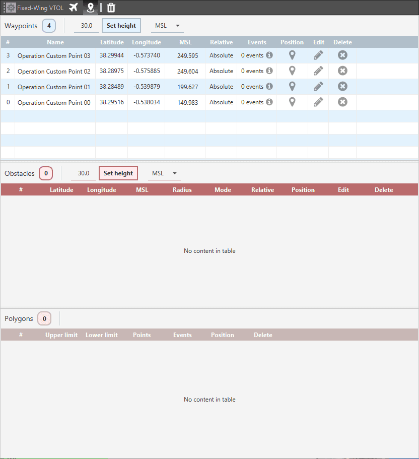
Mission Elements
From here each of the elements can be monitored and their status can be checked or modified. The following fields can be found in this menu:
Name: Element Identifier. Changing the name of any of the waypoints will turn them into operation parameters and also display their name on the map.
Latitude, Longitude and MSL: Element coordinates.
Relative: ‘Absolute’ means that the position of the element is fixed, while ‘Relative’ indicates its position is relative to the position of another element and it may vary during the operation.
Events: List of any events that are linked to the position of this element, such as triggers for automatic actions.
Position: Clicking here will center the element on the map.
Edit: open the edition menu for this element. It is also possible to modify the altitude of all of the listed elements at the same time by using the Set height feature on the top of each list.
Delete: remove this operatioon element.
Loading a new mission
Using the feature Set Operation it is possible to replace the current mission by another one that was previously exported.
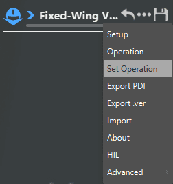
Set Operation
This allows the user to build a mission library that can then be used to load an operation from a set of pre-defined missions.
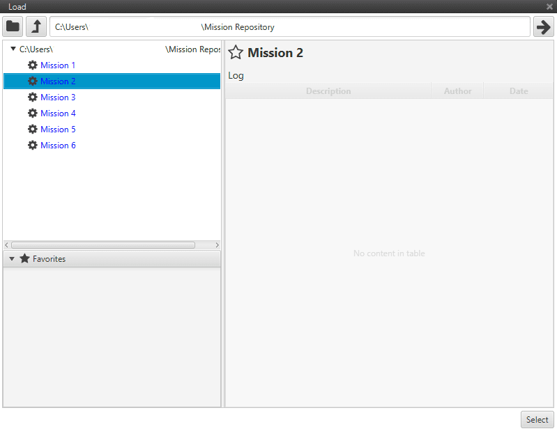
Operation Library
Modifying the current mission
The current mission can be modified at any point using the options
described above, or by means of the Mission Building Tools mission, and
then clicking on the Save ![]() button.
button.
It is also possible to make temporary changes to the current mission by using Detour commands.